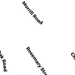
82 ROSEMARY STREET
Owner Information
ITTERLY, SALLY A
82 ROSEMARY STREET
NORWOOD, MA 02062


Property Details
82 ROSEMARY STREET is classified as a Single Family Residential (Colonial).
The primary structure on this property was built in 1945. There are 2,842ft2 of built area within this property. There is 1,330ft2 of residential/living space within this property. This property is listed as having 6 rooms.
82 ROSEMARY STREET is valued at $471,900. The land is valued at $241,400 and the structures are valued at $230,500.
This property is in Zone S2. Confirm with local Zoning Board authorities to ensure there are no overlays or other easements on this property.
The most recent deed for 82 ROSEMARY STREET is recorded at the local registrar in Book 28210, Page 0084. 82 ROSEMARY STREET was last sold on Friday, October 29, 2010 for $369,000.
Assessment data from fiscal year 2022.
Flood Data
According to the FEMA National Flood Hazard Layer, this property does not appear to be in a flood zone. It may also be in an area not yet reviewed. Nonetheless, confirm this information prior to taking any action.
To view the flood hazards around this property, create a FEMA "Firmette" Map of the area around 82 ROSEMARY STREET.
Broadband Internet Providers
| Provider | Type | Bandwidth (mbps) | |
|---|---|---|---|
| HughesNet | Satellite | 25 | 3 |
| VSAT Systems, LLC. | Satellite | 2 | 1 |
| GCI Communication Corp. | Satellite | 0 | 0 |
| Comcast | Cable | 1000 | 35 |
| Verizon New England Inc. | Fiber | 940 | 880 |
| Viasat Inc | Satellite | 100 | 3 |
Broadband service provider data from December 2020.
Adjacent Properties
- 39 OAK ROAD
Single Family Residential owned by HENRY, FRANCIS M - 72 ROSEMARY STREET
Single Family Residential owned by POWELL, DAVID F & - 43 OAK ROAD
Single Family Residential owned by KELLEY-MCCARTHY, ANNE M - 47 OAK ROAD
Single Family Residential owned by RODRIGUEZ, WILLIAM JR - 92 ROSEMARY STREET
Single Family Residential owned by BEDARD, ERIC